- April 24, 2024

-
-
Loading
Loading
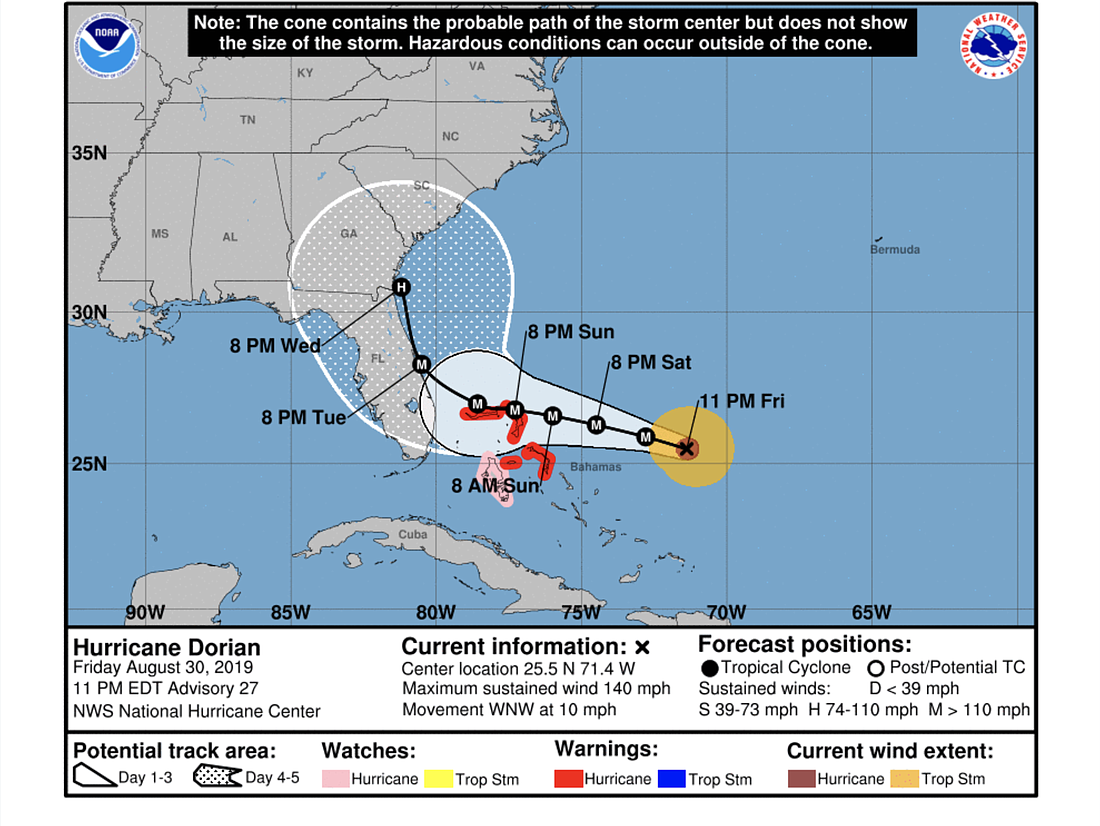
Forecasts as of the night of Friday, Aug. 30, continue to show Hurricane Dorian making landfall in Florida at about 8 p.m. Tuesday, Sept. 3, and then turning north to follow the coast toward Georgia.
Models diverge on whether it will head north over the peninsula or just off the coast.
"Although the official forecast track has been nudged northeastward to near the east coast of Florida, the risk of significant impacts over much of the Florida peninsula remains high," the National Hurricane Center's 11 p.m. update message on Friday, Aug. 30 states.
The hurricane strengthened to a Category 4 on Friday afternoon and is still expected to strengthen somewhat as it passes over warm open water, with expected wind speeds of 150 miles per hour.
The National Hurricane Center's tracking map shows a landfall further north than models earlier in the day had predicted, nearer Melbourne than Port St. Lucie.
The storm is expected to make landfall as a Category 4 and is moving west-northwest at 9 knots.
"Although some decrease in wind speed could occur when Dorian slows down and causes some upwelling, all indications are that Dorian will remain an extremely powerful hurricane for the next several days," the NHC message states.