
- April 23, 2024

-
-
Loading
Loading
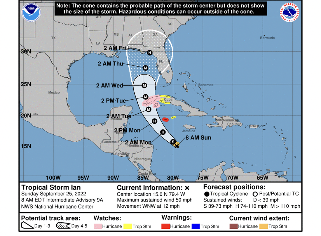
The last storm tracking from the National Hurricane Center shows Tropical Storm Ian shifting west as it approaches Florida's Gulf coast, with a possible landfall in the Big Bend area, near Tallahassee.
But, the NHC warned in an update the morning of Sept. 5, "uncertainty in the long-term track and intensity forecast is higher than usual," and the Flagler-Volusia area remains within the cone of uncertainty.
The storm is expected to cross the Gulf as a major hurricane — a Category 3 or higher — during the middle of the coming week, and potentially weaken to a Category 2 or below by landfall in the early morning hours of Friday, Sept. 30.
"Regardless of lan's exact track and intensity, there is a risk of dangerous storm surge, hurricane-force winds, and heavy rainfall along the west coast of Florida and the Florida Panhandle by the middle of the week," the NHC's update states.
Officials have advised residents to prepare for potential flooding, as Ian may bring significant rain and interact with king tides to cause storm surge. For information on how to prepare, see the links in the box at the top left of this story.