- April 19, 2024

-
-
Loading
Loading
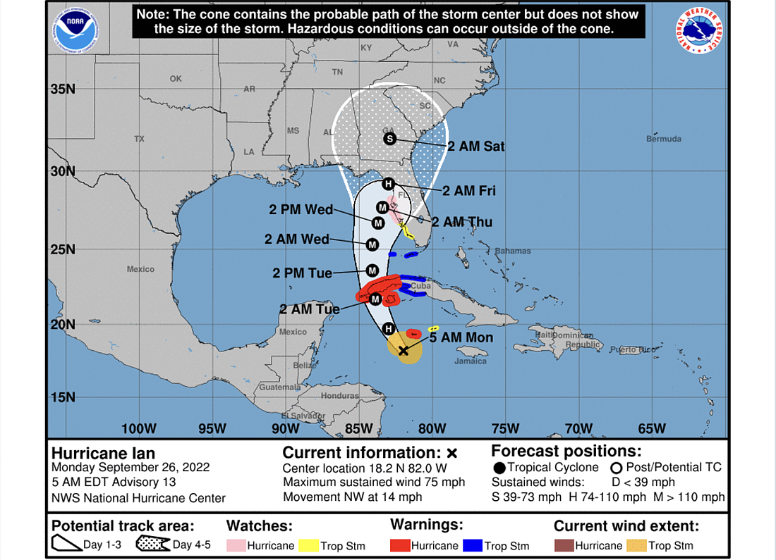
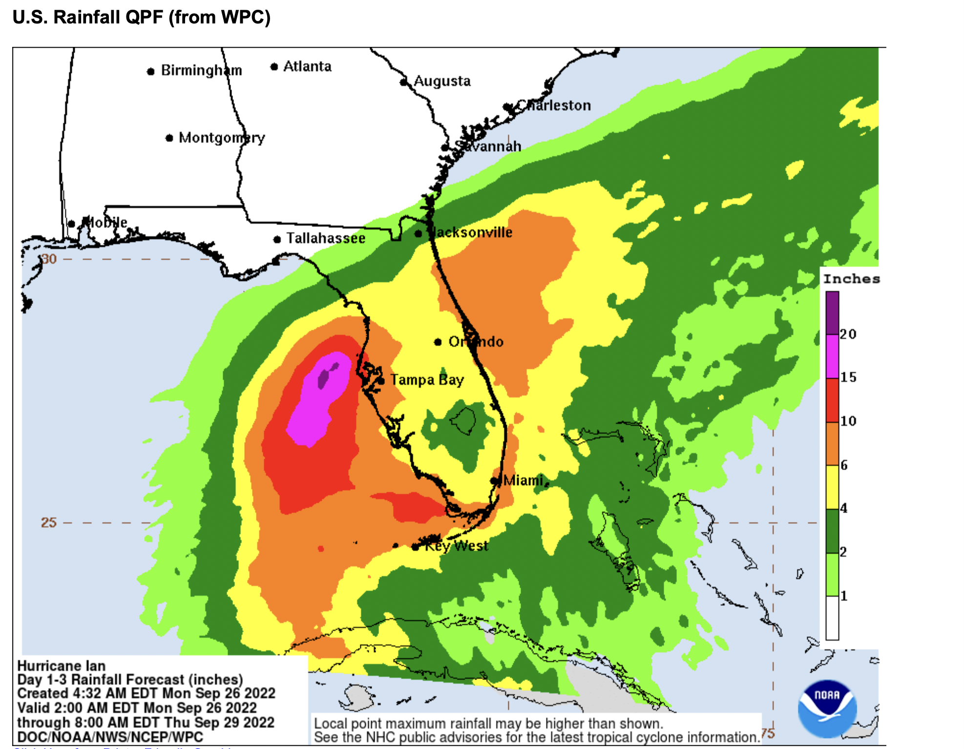
Ian strengthened into a hurricane overnight and is continuing on its path toward the Florida Gulf Coast as of the morning of Monday, Sept. 26.
It is expected to further strengthen into a major hurricane of Category 3 or higher as it crosses the Gulf of Mexico, but weaken to a Category 2 or lower before making landfall.
The storm's expected landfall area has shifted slightly southeast since yesterday, with latest projections showing it grazing Tampa and entering the peninsula in the Steinhatchee area, then heading straight north toward Georgia, rather than arcing east across the state.
A hurricane watch is in effect from north of Englewood to the Tampa Bay area.
Flagler County and Volusia County remain in the cone of uncertainty, and the storm is expected to bring significant rain and interact with a king tide cycle and marine effects from Hurricane Fiona to bring storm surge and potential flooding.
Sandbags are being distributed in Volusia County and Flagler County. For Volusia County sandbag information, click HERE. For Flagler County sandbag information, click HERE. For local emergency preparedness resources and links to storm tracking data and evacuation information, use the links in the box at left.